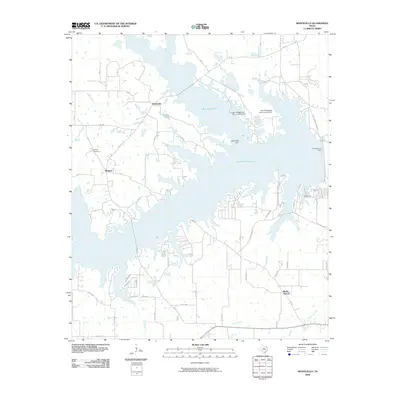
2010 Map of Monticello
USGS Topo · Published 2010About this map
Lake Bob Sandlin and Lake Monticello dominate the landscape in this northeast Texas region, revealing a geography shaped by significant water management and industrial development. The impoundment of these waters is evidenced by several large-scale structures, including the Monticello Dam and the John B Stephens Junior Lake A Dam. Scattered around these reservoirs are older communities such as Monticello and Blodgett, which serve as anchors for local history alongside the Brantley Cemetery.
Find a feature on this map
64 named features on this map. Tap any name to fly to it.
Don’t see what you’re looking for? This feature index may not catch every label — zoom into the map to look around manually.
Map Details
Editions of this 2010 Monticello Map
This is the sole edition of this map. No revisions or reprints were ever made.
Other maps of this area

1953 · Texarkana
USGS Topo · 1:250,000

1956 · Texarkana
USGS Topo · 1:250,000

1956 · Tyler
USGS Topo · 1:250,000

1960 · Newsome
USGS Topo · 1:24,000

1960 · Leesburg
USGS Topo · 1:24,000

1960 · Pittsburg
USGS Topo · 1:24,000

1964 · Mount Vernon
USGS Topo · 1:24,000

1964 · Harvard
USGS Topo · 1:24,000

1965 · Winfield
USGS Topo · 1:24,000

1965 · Monticello
USGS Topo · 1:24,000