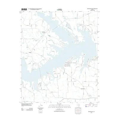
2013 Map of Monticello
USGS Topo · Published 2013About this map
The sprawling waters of Monticello Reservoir dominate this part of Northeast Texas, where the landscape is defined by the irregular fingers of the lake reaching into the surrounding terrain. To the north, the small community of Monticello sits near the reservoir's upper reaches, while Blodgett and Rocky Mound occupy the lands to the west and southeast respectively. These settlements are connected by an intricate network of rural roads and state routes, including F-M-2882 and FM-127, which thread between various watercourses such as Jakes Cr and Picket Spring Br. Local history is anchored at sites like Brantley Cem, positioned near the western edge of the map. The layout reflects a contemporary rural economy where the reservoir serves as a central geographic and likely industrial or recreational hub for these small East Texas communities.
Find a feature on this map
118 named features on this map. Tap any name to fly to it.
Don’t see what you’re looking for? This feature index may not catch every label — zoom into the map to look around manually.
Map Details
Editions of this 2013 Monticello Map
This is the sole edition of this map. No revisions or reprints were ever made.
Other maps of this area

1953 · Texarkana
USGS Topo · 1:250,000

1956 · Texarkana
USGS Topo · 1:250,000

1956 · Tyler
USGS Topo · 1:250,000

1960 · Newsome
USGS Topo · 1:24,000

1960 · Leesburg
USGS Topo · 1:24,000

1960 · Pittsburg
USGS Topo · 1:24,000

1964 · Mount Vernon
USGS Topo · 1:24,000

1964 · Harvard
USGS Topo · 1:24,000

1965 · Winfield
USGS Topo · 1:24,000

1965 · Monticello
USGS Topo · 1:24,000