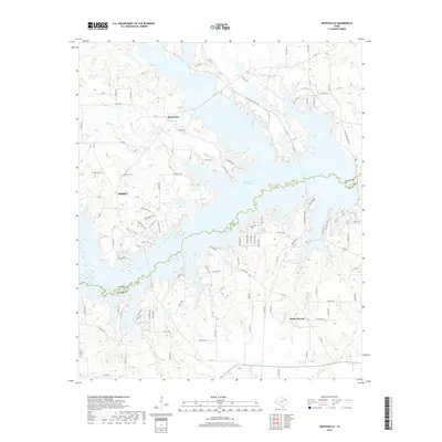
2019 Map of Monticello
USGS Topo · Published 2019About this map
The Monticello Reservoir dominates the landscape of this East Texas region, its winding shoreline crossing the boundary between Titus and Camp Counties. The settlement of Monticello sits just north of the water, while Rocky Mound and Blodgett occupy the higher ground to the south and west. This area, recorded in the late 2010s, is defined by its hydrology and the local infrastructure supporting the nearby reservoir, including the Monticello Plant Rd and Fort Sherman Dam Rd.
Find a feature on this map
108 named features on this map. Tap any name to fly to it.
Don’t see what you’re looking for? This feature index may not catch every label — zoom into the map to look around manually.
Map Details
Editions of this 2019 Monticello Map
This is the sole edition of this map. No revisions or reprints were ever made.
Other maps of this area

1953 · Texarkana
USGS Topo · 1:250,000

1956 · Texarkana
USGS Topo · 1:250,000

1956 · Tyler
USGS Topo · 1:250,000

1960 · Newsome
USGS Topo · 1:24,000

1960 · Leesburg
USGS Topo · 1:24,000

1960 · Pittsburg
USGS Topo · 1:24,000

1964 · Mount Vernon
USGS Topo · 1:24,000

1964 · Harvard
USGS Topo · 1:24,000

1965 · Winfield
USGS Topo · 1:24,000

1965 · Monticello
USGS Topo · 1:24,000