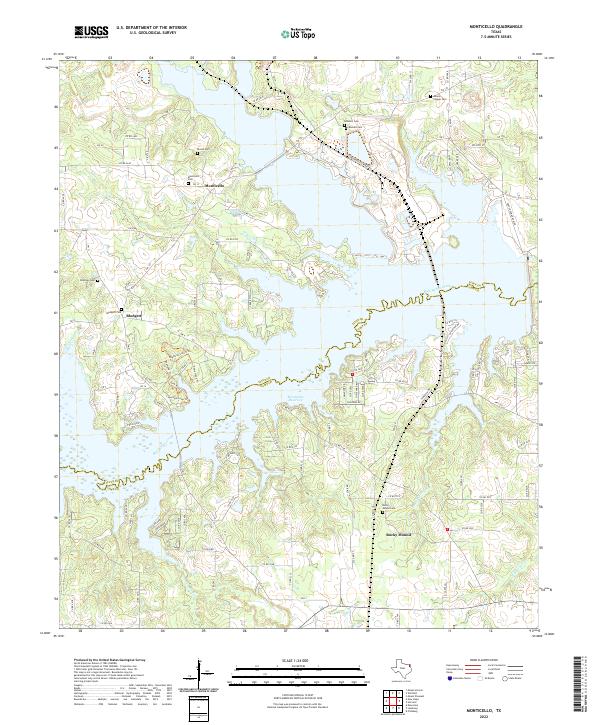
2022 Map of Monticello
USGS Topo · Published 2022About this map
The Monticello Reservoir and the meandering Big Cypress Creek dominate this corner of East Texas, where the border between Titus Co and Camp Co follows the natural drainage of the creek bed. Small settlements like Monticello, Blodgett, and Rocky Mound are scattered across a landscape defined by its rural road network and deep genealogical roots. The area is particularly rich in family and community burial grounds, including the Adams Chapel Cem, Blundell Cem, and Brantley Cem. The presence of the Monticello Plant Rd and various Farm to Market roads like FM 127 and FM 21 indicates the intersection of industrial activity and local transit. Tributaries such as Jakes Cr, Andys Cr, and Picket Spring Br feed into the larger reservoir system, shaping the topography of this timbered region.
Find a feature on this map
96 named features on this map. Tap any name to fly to it.
Don’t see what you’re looking for? This feature index may not catch every label — zoom into the map to look around manually.
Map Details
Editions of this 2022 Monticello Map
This is the sole edition of this map. No revisions or reprints were ever made.
Other maps of this area

1953 · Texarkana
USGS Topo · 1:250,000

1956 · Texarkana
USGS Topo · 1:250,000

1956 · Tyler
USGS Topo · 1:250,000

1960 · Newsome
USGS Topo · 1:24,000

1960 · Leesburg
USGS Topo · 1:24,000

1960 · Pittsburg
USGS Topo · 1:24,000

1964 · Mount Vernon
USGS Topo · 1:24,000

1964 · Harvard
USGS Topo · 1:24,000

1965 · Winfield
USGS Topo · 1:24,000

1965 · Monticello
USGS Topo · 1:24,000