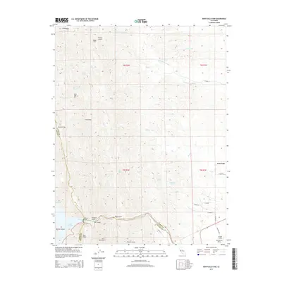
2015 Map of Monticello Dam
USGS Topo · Published 2015About this map
Monticello Dam stands as the centerpiece of this terrain, anchoring the southeastern reach of Lake Berryessa at the borders of Napa, Yolo, and Solano counties. The landscape transitions sharply from the rugged elevations of the Vaca Mountains and Blue Ridge into the flat expanses of the Sacramento Valley. Water is the defining element of the region, where Putah Creek flows eastward from the dam toward the town of Winters. Higher in the ridges, numerous named sources like Buckhorn Spring and Grapevine Spring feed the complex drainage system of Chickahominy Slough and Enos Cr. This map documents a high-relief environment where steep canyons such as Cold Canyon and Thompson Canyon meet the agricultural edge of the valley, traced by rural routes like El Camino and Sackett Ln.
Find a feature on this map
48 named features on this map. Tap any name to fly to it.
Don’t see what you’re looking for? This feature index may not catch every label — zoom into the map to look around manually.
Map Details
Editions of this 2015 Monticello Dam Map
This is the sole edition of this map. No revisions or reprints were ever made.
Other maps of this area

1902 · Napa
USGS Topo · 1:125,000

1905 · Esparto
USGS Topo · 1:24,000

1907 · Woodland
USGS Topo · 1:62,500

1908 · Vacaville
USGS Topo · 1:62,500

1916 · Jacobs Corner
USGS Topo · 1:31,680

1916 · Winters
USGS Topo · 1:31,680

1916 · Esparto
USGS Topo · 1:31,680

1917 · Wolfskill
USGS Topo · 1:31,680

1921 · Mt. Vaca
USGS Topo · 1:62,500

1924 · Capay
USGS Topo · 1:62,500