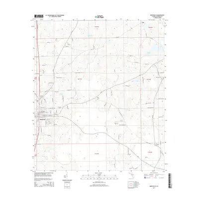
2015 Map of Monticello
USGS Topo · Published 2015About this map
Monticello serves as the focal point for this North Florida landscape, where the grid of the town site meets the irregular paths of the surrounding agricultural and timber lands. The area is marked by a notable density of small burial grounds, such as Mount Zion Cem and Texas Hill Cem, reflecting a deep-rooted pattern of rural family and community settlement. Moving eastward from the town center, the terrain transitions toward a network of wetlands and creeks, including the drainage of Wolf Cr and isolated bodies of water like Razor Lake and Simpson Lake. The settlement of Texas Hill sits just northwest of the main town, while smaller outposts like Dills to the north indicate the historical reach of local trade routes. Throughout the quadrangle, long-established roads such as Dills Rd and Bassett Dairy Rd connect these scattered homesteads and pastures, preserving the early 21st-century rural character of Jefferson County.
Find a feature on this map
99 named features on this map. Tap any name to fly to it.
Don’t see what you’re looking for? This feature index may not catch every label — zoom into the map to look around manually.
Map Details
Editions of this 2015 Monticello Map
This is the sole edition of this map. No revisions or reprints were ever made.
Other maps of this area

1954 · Greenville
USGS Topo · 1:24,000

1954 · Valdosta
USGS Topo · 1:250,000

1955 · Lamont
USGS Topo · 1:24,000

1955 · Waukeenah
USGS Topo · 1:24,000

1956 · Grooverville
USGS Topo · 1:24,000

1956 · Monticello NE
USGS Topo · 1:24,000

1956 · Metcalf
USGS Topo · 1:24,000

1958 · Valdosta
USGS Topo · 1:250,000

1959 · Valdosta
USGS Topo · 1:250,000

1962 · Ashville
USGS Topo · 1:24,000