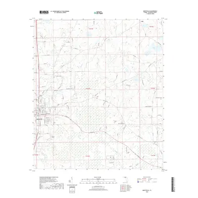
2018 Map of Monticello
USGS Topo · Published 2018About this map
The county seat of Monticello serves as the focal point of this Jefferson County landscape, characterized by a detailed street grid and numerous historic burial sites. The town's layout includes many named thoroughfares such as E Washington St and King St, leading outward toward the smaller settlements of Texas Hill and Dills. Genealogists will find a wealth of data in the many scattered cemeteries, including Mount Zion Cem, Milton Cem, and Elizabeth Cem, which dot the surrounding countryside.
Find a feature on this map
80 named features on this map. Tap any name to fly to it.
Don’t see what you’re looking for? This feature index may not catch every label — zoom into the map to look around manually.
Map Details
Editions of this 2018 Monticello Map
This is the sole edition of this map. No revisions or reprints were ever made.
Other maps of this area

1954 · Greenville
USGS Topo · 1:24,000

1954 · Valdosta
USGS Topo · 1:250,000

1955 · Lamont
USGS Topo · 1:24,000

1955 · Waukeenah
USGS Topo · 1:24,000

1956 · Grooverville
USGS Topo · 1:24,000

1956 · Monticello NE
USGS Topo · 1:24,000

1956 · Metcalf
USGS Topo · 1:24,000

1958 · Valdosta
USGS Topo · 1:250,000

1959 · Valdosta
USGS Topo · 1:250,000

1962 · Ashville
USGS Topo · 1:24,000