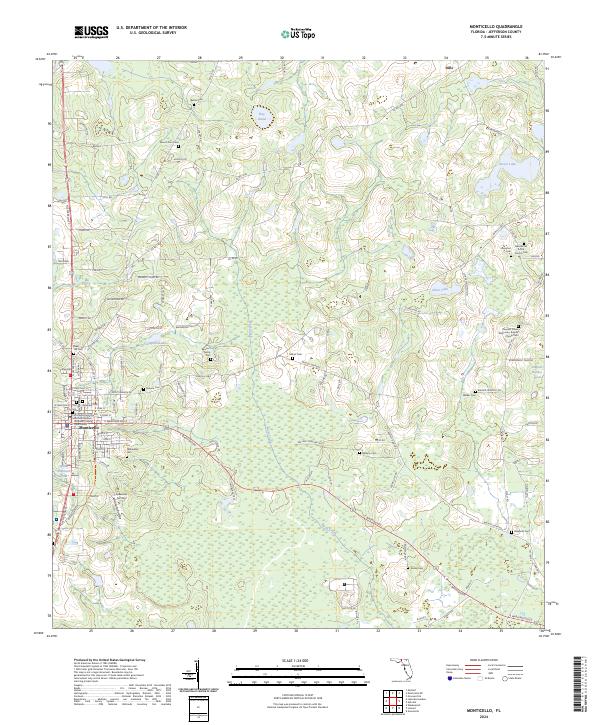
2024 Map of Monticello
USGS Topo · Published 2024About this map
Monticello serves as the focal point of this Jefferson County landscape, dominated by a dense concentration of civic and religious sites that reflect the region's deep-rooted social history. The Jefferson County Courthouse stands at the center of the community, surrounded by a high density of burial grounds including the Old City Cem, Roseland Cem, and the unique Pallbearers Cem. The map reveals a land divided by traditional agricultural boundaries and a network of ponds such as Hay Pond and Back Pond to the north, which give way to more developed nurseries like the Simpson Nursery further south.
Find a feature on this map
128 named features on this map. Tap any name to fly to it.
Don’t see what you’re looking for? This feature index may not catch every label — zoom into the map to look around manually.
Map Details
Editions of this 2024 Monticello Map
This is the sole edition of this map. No revisions or reprints were ever made.
Other maps of this area

1954 · Greenville
USGS Topo · 1:24,000

1954 · Valdosta
USGS Topo · 1:250,000

1955 · Lamont
USGS Topo · 1:24,000

1955 · Waukeenah
USGS Topo · 1:24,000

1956 · Grooverville
USGS Topo · 1:24,000

1956 · Monticello NE
USGS Topo · 1:24,000

1956 · Metcalf
USGS Topo · 1:24,000

1958 · Valdosta
USGS Topo · 1:250,000

1959 · Valdosta
USGS Topo · 1:250,000

1962 · Ashville
USGS Topo · 1:24,000