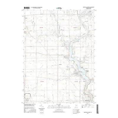
2016 Map of Monticello North
USGS Topo · Published 2016About this map
The Tippecanoe River carves a deep valley through this portion of White County, anchored by the resort atmosphere of Indiana Beach and the extensive waters of Lake Shafer. This 2016 survey illustrates the modern landscape of Monticello, where the river's flow is managed through a series of inlets like Keans Bay and Honey Creek Bay. The surrounding agricultural tableland is defined by a dense network of drainage infrastructure, including the Hoagland Ditch, Mckillip Ditch, and Beller-McCollum Ditch, which support the rural stretches between Monon and Buffalo.
Find a feature on this map
88 named features on this map. Tap any name to fly to it.
Don’t see what you’re looking for? This feature index may not catch every label — zoom into the map to look around manually.
Map Details
Editions of this 2016 Monticello North Map
This is the sole edition of this map. No revisions or reprints were ever made.
Other maps of this area

1953 · Danville
USGS Topo · 1:250,000

1955 · Danville
USGS Topo · 1:250,000

1956 · Danville
USGS Topo · 1:250,000

1962 · Buffalo
USGS Topo · 1:24,000

1962 · Monticello South
USGS Topo · 1:24,000

1962 · Monon NE
USGS Topo · 1:24,000

1962 · Brookston NW
USGS Topo · 1:24,000

1962 · Monon
USGS Topo · 1:24,000

1962 · Monticello North
USGS Topo · 1:24,000
1962 · Francesville
USGS Topo · 1:24,000