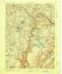
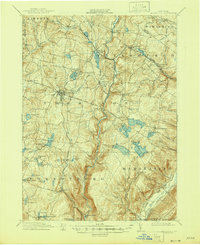
1911 Map of Monticello
USGS Topo · Published 1925About this map
The village of Monticello and its surrounding Catskill foothills are meticulously detailed in this early twentieth-century survey, reflecting an era when Sullivan County was transitioning into a premier vacation destination. The New York Ontario and Western RR cuts a winding path through the landscape, connecting specialized stops like Hurleyville Luzen Sta and Merriewold St Josephs Sta, which served the burgeoning resort and religious communities of the time.
Find a feature on this map
85 named features on this map. Tap any name to fly to it.
Don’t see what you’re looking for? This feature index may not catch every label — zoom into the map to look around manually.
Map Details
Editions of this 1911 Monticello Map
6 editions found

Other maps of this area

1903 · Slide Mountain
USGS Topo · 1:62,500

1904 · Ellenville
USGS Topo · 1:62,500

1905 · Slide Mountain
USGS Topo · 1:62,500

1906 · Ellenville
USGS Topo · 1:62,500

1906 · Port Jervis
USGS Topo · 1:62,500

1906 · Goshen
USGS Topo · 1:62,500

1908 · Goshen
USGS Topo · 1:62,500

1908 · Port Jervis
USGS Topo · 1:62,500

1909 · Monticello
USGS Topo · 1:62,500

1910 · Neversink
USGS Topo · 1:62,500