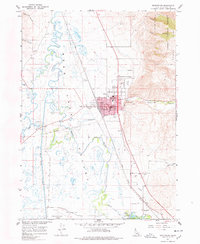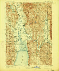
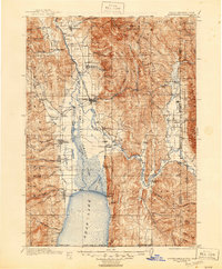
1911 Map of Montpelier
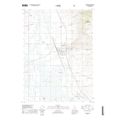
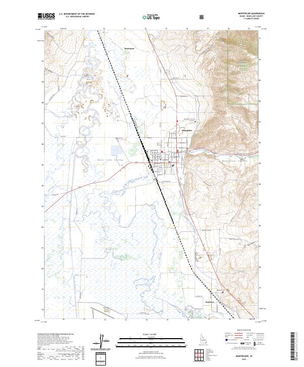
USGS Topo · Published 1927About this map
Montpelier and the surrounding Bear Lake Valley are captured here as a critical transportation and agricultural hub near the junction of Idaho, Wyoming, and Utah. The Oregon Short Line Railroad dictates the valley's development, connecting settlements like Pescadero, Dingle Sta, and Pegram along the Bear River corridor. The hydrological landscape is remarkably complex, showing the Bear Lake Outlet and the Telluride Canal managing the flow between the northern shores of Bear Lake and the expansive Dingle Swamp. This early 20th-century survey highlights the tension between the high peaks of the Caribou Mountains and the irrigated valley floor, where established towns like Paris, St Charles, and Bloomington sit at the base of the Bear River Range. The map also documents the remote high-country outposts of the Caribou National Forest and Cache National Forest during the early years of federal forest management.
Find a feature on this map
89 named features on this map. Tap any name to fly to it.
Don’t see what you’re looking for? This feature index may not catch every label — zoom into the map to look around manually.
Map Details
Editions of this 1911 Montpelier Map
3 editions found

Historical Maps of Montpelier Through Time
8 maps found