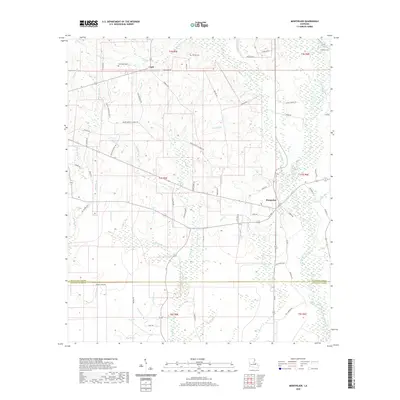
2020 Map of Montpelier
USGS Topo · Published 2020About this map
The Tickfaw River corridor defines this portion of the Florida Parishes, where the terrain transitions across the boundary of St. Helena Parish and Livingston Parish. The village of Montpelier serves as the primary settlement, situated near the confluence of several local watercourses including Bear Cr and Twelvemile Cr. The landscape is etched with numerous small branches and creeks, such as Jordan Br and Mitchell Br, reflecting the intricate drainage patterns of the region's piney woods and bottomlands. Evidence of long-standing community hubs is found in several historic burial sites, including New Hope Cem, George Cem, and Hillsdale Cem. Farther north, the small locality of Jack sits near the upper reaches of Teal McDaniel Br, connected by a network of rural routes like Shiloh Baptist Church Rd and New Hope Rd that trace the area's agricultural and timber-based heritage.
Find a feature on this map
77 named features on this map. Tap any name to fly to it.
Don’t see what you’re looking for? This feature index may not catch every label — zoom into the map to look around manually.
Map Details
Editions of this 2020 Montpelier Map
This is the sole edition of this map. No revisions or reprints were ever made.
Other maps of this area

1940 · Roseland
USGS Topo · 1:31,680

1941 · Gilead
USGS Topo · 1:31,680

1942 · Roseland
USGS Topo · 1:31,680

1942 · Montpelier
USGS Topo · 1:31,680

1942 · Pine Grove
USGS Topo · 1:31,680

1942 · Gilead
USGS Topo · 1:31,680

1942 · Satsuma
USGS Topo · 1:31,680

1949 · Amite
USGS Topo · 1:31,680

1949 · Albany
USGS Topo · 1:31,680

1950 · Doyle
USGS Topo · 1:31,680