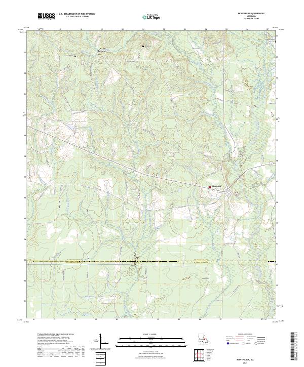
2024 Map of Montpelier
USGS Topo · Published 2024About this map
The Tickfaw River winds through the eastern edge of this landscape, anchoring the village of Montpelier and its surrounding countryside. This region of St. Helena Parish is defined by a dense network of watercourses, including Bear Creek and Twelvemile Creek, which carve through the terrain and influence the placement of local thoroughfares like State Rte 449 and Shiloh Baptist Church Rd. The map reveals a community deeply rooted in its local geography, with several small settlements such as Jack situated amidst the pine-scattered lowlands.
Find a feature on this map
85 named features on this map. Tap any name to fly to it.
Don’t see what you’re looking for? This feature index may not catch every label — zoom into the map to look around manually.
Map Details
Editions of this 2024 Montpelier Map
This is the sole edition of this map. No revisions or reprints were ever made.
Other maps of this area

1940 · Roseland
USGS Topo · 1:31,680

1941 · Gilead
USGS Topo · 1:31,680

1942 · Roseland
USGS Topo · 1:31,680

1942 · Montpelier
USGS Topo · 1:31,680

1942 · Pine Grove
USGS Topo · 1:31,680

1942 · Gilead
USGS Topo · 1:31,680

1942 · Satsuma
USGS Topo · 1:31,680

1949 · Amite
USGS Topo · 1:31,680

1949 · Albany
USGS Topo · 1:31,680

1950 · Doyle
USGS Topo · 1:31,680