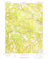
1958 Map of Montville
USGS Topo · Published 1966About this map
Oxoboxo Lake and the Oxoboxo Brook valley serve as the industrial and residential heart of this region in the late 1950s, anchoring settlements like Oakdale and Montville. The landscape is a complex network of small reservoirs and mill ponds, including Rockland Pond, Schofield Pond, and Red Mill Pond, reflecting a legacy of water-powered industry along the narrow valleys. In the western portion, the Salem and East Lyme borderlands show a more dispersed rural character, dotted with family-named landmarks such as Forsythe Hill and several private burial grounds like Salem Cem.
Find a feature on this map
90 named features on this map. Tap any name to fly to it.
Don’t see what you’re looking for? This feature index may not catch every label — zoom into the map to look around manually.
Map Details
Editions of this 1958 Montville Map
4 editions found
Other maps of this area

1892 · New London
USGS Topo · 1:62,500

1892 · Norwich
USGS Topo · 1:62,500

1892 · Gilead
USGS Topo · 1:62,500

1893 · New London
USGS Topo · 1:62,500

1893 · Saybrook
USGS Topo · 1:62,500

1921 · New London
USGS Topo · 1:62,500

1934 · Niantic
USGS Topo · 1:24,000

1935 · Montville
USGS Topo · 1:24,000

1938 · New London
USGS Topo · 1:31,680

1938 · Niantic
USGS Topo · 1:62,500