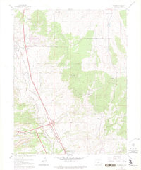
1961 Map of Monument
USGS Topo · Published 1975About this map
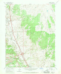
Palmer Lake and Monument serve as the primary northern hubs in this section of the Front Range during the early 1960s. The landscape is defined by the expansive United States Air Force Academy grounds to the south and the wooded heights of the Black Forest. Transportation through this corridor is dominated by the parallel routes of the Atchison Topeka and Santa Fe and the Denver and Rio Grande Western railroads, which trace the path of Monument Creek. The map records a transition from traditional agricultural life to institutional and suburban development, shown through the presence of നിരവധി namesake properties like Wissler Ranch and Hardesty Ranch alongside the Mt Herman Grange and the Black Forest Baptist Assembly. Local drainage is detailed through numerous named waterways including Dirty Woman Creek and Black Squirrel Creek.
Find a feature on this map
39 named features on this map. Tap any name to fly to it.
Don’t see what you’re looking for? This feature index may not catch every label — zoom into the map to look around manually.
Map Details
Editions of this 1961 Monument Map
7 editions found
Other maps of this area

1893 · Colorado Springs
USGS Topo · 1:125,000

1894 · Castle Rock
USGS Topo · 1:125,000

1909 · Colorado Springs
USGS Topo · 1:125,000

1913 · Castle Rock
USGS Topo · 1:125,000

1940 · Elbert
USGS Topo · 1:62,500

1942 · Colorado Springs
USGS Topo · 1:125,000

1944 · Elbert
USGS Topo · 1:62,500

1948 · Colorado Springs
USGS Topo · 1:62,500

1948 · Pikeview
USGS Topo · 1:24,000

1948 · Cascade
USGS Topo · 1:24,000