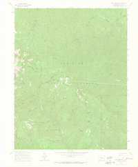
1963 Map of Monument Hill
USGS Topo · Published 1965About this map
Mining operations and narrow gulches define this segment of the San Juan National Forest as it was mapped in the early 1960s. The landscape is marked by a history of extraction, featuring named sites like the Neglected Mine, Muldoon Mine, and Mary S Mine tucked into various drainages. These operations are linked to the surrounding terrain by a network of jeep and pack trails that navigate the complex system of ravines, including Mineral Wonder Gulch and Fassbinder Gulch.
Find a feature on this map
53 named features on this map. Tap any name to fly to it.
Don’t see what you’re looking for? This feature index may not catch every label — zoom into the map to look around manually.
Map Details
Editions of this 1963 Monument Hill Map
4 editions found
Other maps of this area

1895 · La Plata
USGS Topo · 1:62,500

1897 · La Plata
USGS Topo · 1:62,500

1897 · Rico
USGS Topo · 1:62,500

1898 · Durango
USGS Topo · 1:62,500

1898 · Engineer Mountain
USGS Topo · 1:62,500

1898 · Rico
USGS Topo · 1:62,500

1899 · La Plata
USGS Topo · 1:62,500

1899 · Rico
USGS Topo · 1:62,500

1900 · Engineer Mountain
USGS Topo · 1:62,500

1907 · Durango
USGS Topo · 1:62,500