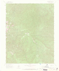
1963 Map of Monument Hill
USGS Topo · Published 1972About this map
Neglected Mine and the Mary S Mine sit among the high drainages of the San Juan National Forest in this 1963 survey. The landscape is defined by deep incisions from South Fork Hermosa Creek and Clear Creek, creating a network of gulches such as Mingral Gulch and Stambull Gulch. Mining activity is clustered near Monument Hill, while the higher elevations are marked by landmarks like Sheephead Basin and Sliderock Mountain.
Find a feature on this map
42 named features on this map. Tap any name to fly to it.
Don’t see what you’re looking for? This feature index may not catch every label — zoom into the map to look around manually.
Map Details
Editions of this 1963 Monument Hill Map
4 editions found
Other maps of this area

1895 · La Plata
USGS Topo · 1:62,500

1897 · La Plata
USGS Topo · 1:62,500

1897 · Rico
USGS Topo · 1:62,500

1898 · Durango
USGS Topo · 1:62,500

1898 · Engineer Mountain
USGS Topo · 1:62,500

1898 · Rico
USGS Topo · 1:62,500

1899 · La Plata
USGS Topo · 1:62,500

1899 · Rico
USGS Topo · 1:62,500

1900 · Engineer Mountain
USGS Topo · 1:62,500

1907 · Durango
USGS Topo · 1:62,500