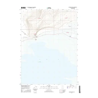
2017 Map of Monument Point
USGS Topo · Published 2017About this map
Great Salt Lake dominates the southern half of this landscape, its expansive waters meeting the shore at Spring Bay. The terrain transitions sharply to the north as the Hansel Mountains rise above the basin, creating a dramatic topographical contrast between the lakebed and the upland slopes. A primary feature of historical interest is the Old Railroad Grade Rd, which traces a level path through the Curlew Valley, marking the corridor of former transcontinental rail travel. Near the shoreline, Monument Point serves as a distinct landmark alongside the brackish expanse of Salt Wells Flat. Small water features like Pothole Springs and isolated geological formations such as Lone Rock dot the interface between the arid mountains and the salt-encrusted flats, illustrating the unique hydrology and geology of this northern Utah region.
Find a feature on this map
18 named features on this map. Tap any name to fly to it.
Don’t see what you’re looking for? This feature index may not catch every label — zoom into the map to look around manually.
Map Details
Editions of this 2017 Monument Point Map
This is the sole edition of this map. No revisions or reprints were ever made.
Other maps of this area

1954 · Brigham City
USGS Topo · 1:250,000

1958 · Brigham City
USGS Topo · 1:250,000

1962 · Brigham City
USGS Topo · 1:250,000

1968 · Rozel
USGS Topo · 1:24,000

1968 · Lake Ridge
USGS Topo · 1:24,000

1968 · Monument Point
USGS Topo · 1:24,000

1968 · Coyote Point
USGS Topo · 1:24,000

1968 · Salt Wells
USGS Topo · 1:24,000

1968 · Monument Peak SW
USGS Topo · 1:24,000

1968 · Monument Peak
USGS Topo · 1:24,000