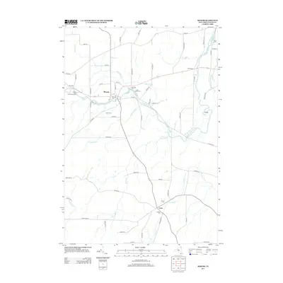
2013 Map of Mooers
USGS Topo · Published 2013About this map
Mooers serves as the primary hub of this Clinton County landscape, where the Great Chazy River winds through a mosaic of agricultural land and scattered rural settlements. The river's path is central to the area's geography, complemented by several tributaries including Sperry Brook and Shedden Brook. Cultural history is anchored by the Mooers Camp Meeting Association and a series of family and community burial grounds, such as Riverside Cem and Saint Josephs Cem. To the south, the smaller hamlet of Sciola sits near the confluence of Bullis Brook and Corbeau Cr, marking a distinct secondary center of activity. The map reflects a long-established agricultural pattern, evidenced by tracts like Larato Farms and the network of country roads connecting isolated farmsteads across the northern New York borderlands.
Find a feature on this map
64 named features on this map. Tap any name to fly to it.
Don’t see what you’re looking for? This feature index may not catch every label — zoom into the map to look around manually.
Map Details
Editions of this 2013 Mooers Map
This is the sole edition of this map. No revisions or reprints were ever made.
Other maps of this area

1895 · Mooers
USGS Topo · 1:62,500

1895 · Rouse Point
USGS Topo · 1:62,500

1899 · Mooers
USGS Topo · 1:62,500

1907 · Rouse Point
USGS Topo · 1:62,500

1939 · Rouses Point
USGS Topo · 1:62,500

1942 · Mooers
USGS Topo · 1:62,500

1943 · Mooers
USGS Topo · 1:62,500

1943 · Rouses Point
USGS Topo · 1:62,500

1950 · Lake Champlain
USGS Topo · 1:250,000

1956 · Rouses Point
USGS Topo · 1:62,500