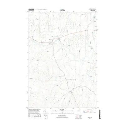
2016 Map of Mooers
USGS Topo · Published 2016About this map
The Great Chazy River flows through the northern Clinton County landscape, anchoring the settlement of Mooers where the river bends sharply near Riverside Cem and Saint Josephs Cem. This 2016 survey illustrates the persistent agricultural and rural character of the region, defined by a network of drainage systems including Shedden Brook, Bullis Brook, and the wetlands known as The Vly. Further south, the community of Sciota serves as a local crossroads, marked by the presence of Jennett Cem and Dragoon Cem. The map provides a clear look at the road network connecting these hamlets, such as Champlain St and Main St, while tracing the meandering path of Corbeau Cr toward the eastern border near the Oxbow. Researchers can identify long-standing property boundaries and small family burial grounds like Mills Cem that dot the northern periphery near Beaver Cr.
Find a feature on this map
65 named features on this map. Tap any name to fly to it.
Don’t see what you’re looking for? This feature index may not catch every label — zoom into the map to look around manually.
Map Details
Editions of this 2016 Mooers Map
This is the sole edition of this map. No revisions or reprints were ever made.
Other maps of this area

1895 · Mooers
USGS Topo · 1:62,500

1895 · Rouse Point
USGS Topo · 1:62,500

1899 · Mooers
USGS Topo · 1:62,500

1907 · Rouse Point
USGS Topo · 1:62,500

1939 · Rouses Point
USGS Topo · 1:62,500

1942 · Mooers
USGS Topo · 1:62,500

1943 · Mooers
USGS Topo · 1:62,500

1943 · Rouses Point
USGS Topo · 1:62,500

1950 · Lake Champlain
USGS Topo · 1:250,000

1956 · Rouses Point
USGS Topo · 1:62,500