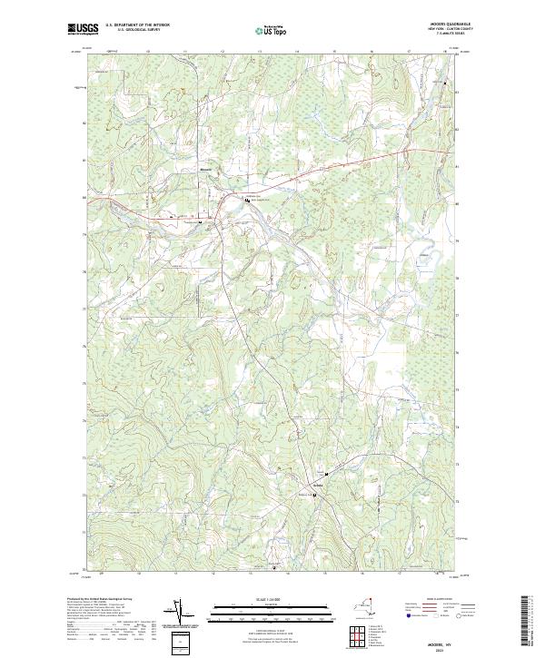
2023 Map of Mooers
USGS Topo · Published 2023About this map
Mooers serves as the central hub of this northern Clinton County landscape, situated where the Great Chazy River winds through the terrain. The river’s path is marked by distinctive hydrological features like the Oxbow and is fed by numerous tributaries, including Sperry Brook and Shedden Brook. For genealogists and local historians, this survey is particularly valuable for its documentation of numerous burial grounds scattered across the township, from Saint Josephs Cem near the town center to the more outlying Dragoon Cem and Stone Cem. Further south, the small settlement of Sciola sits near Corbeau Creek, illustrating the historical distribution of rural communities in this border region. The extensive network of country roads, such as Garrand Rd and Angelville Rd, connects these old farmsteads and points of interest across the marshy lowlands of The Vly.
Find a feature on this map
66 named features on this map. Tap any name to fly to it.
Don’t see what you’re looking for? This feature index may not catch every label — zoom into the map to look around manually.
Map Details
Editions of this 2023 Mooers Map
This is the sole edition of this map. No revisions or reprints were ever made.
Other maps of this area

1895 · Mooers
USGS Topo · 1:62,500

1895 · Rouse Point
USGS Topo · 1:62,500

1899 · Mooers
USGS Topo · 1:62,500

1907 · Rouse Point
USGS Topo · 1:62,500

1939 · Rouses Point
USGS Topo · 1:62,500

1942 · Mooers
USGS Topo · 1:62,500

1943 · Mooers
USGS Topo · 1:62,500

1943 · Rouses Point
USGS Topo · 1:62,500

1950 · Lake Champlain
USGS Topo · 1:250,000

1956 · Rouses Point
USGS Topo · 1:62,500