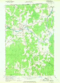
1966 Map of Mooers
USGS Topo · Published 1968About this map
Great Chazy River meanders through the northern reaches of Clinton County, defining the settlement patterns of Mooers and Perry Mills in the late 1960s. This survey records a landscape transition where established community centers like Sciota are anchored by religious landmarks such as St Louis de France Ch and St Josephs Ch. The presence of the Mooers Camp Meeting Association suggests a history of regional gathering, while the Old Railroad Grade and numerous gravel pits point to the area's older industrial and transportation infrastructure near the Canada United States border.
Find a feature on this map
55 named features on this map. Tap any name to fly to it.
Don’t see what you’re looking for? This feature index may not catch every label — zoom into the map to look around manually.
Map Details
Editions of this 1966 Mooers Map
This is the sole edition of this map. No revisions or reprints were ever made.
Other maps of this area

1895 · Mooers
USGS Topo · 1:62,500

1895 · Rouse Point
USGS Topo · 1:62,500

1899 · Mooers
USGS Topo · 1:62,500

1907 · Rouse Point
USGS Topo · 1:62,500

1939 · Rouses Point
USGS Topo · 1:62,500

1942 · Mooers
USGS Topo · 1:62,500

1943 · Mooers
USGS Topo · 1:62,500

1943 · Rouses Point
USGS Topo · 1:62,500

1950 · Lake Champlain
USGS Topo · 1:250,000

1956 · Rouses Point
USGS Topo · 1:62,500