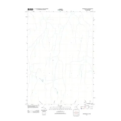
2013 Map of Mooers OE N
USGS Topo · Published 2013About this map
Perry Mills sits at the southern edge of this North Country landscape, where the rural terrain begins its transition toward the international border. The settlement pattern is defined by a sparse network of long-established thoroughfares such as Hogle Rd and Gokey Rd, which cut through a landscape of wetlands and woodlots typical of the Clinton County interior. The presence of the Murray Cem near the junction of Roxham Rd and Perry Mills Rd provides a specific point of interest for genealogists tracing local families in this quiet borderland region. This 2013 survey illustrates the modern configuration of these historic town roads and drainage patterns in a largely undeveloped area of northern New York.
Find a feature on this map
8 named features on this map. Tap any name to fly to it.
Don’t see what you’re looking for? This feature index may not catch every label — zoom into the map to look around manually.
Map Details
Editions of this 2013 Mooers OE N Map
This is the sole edition of this map. No revisions or reprints were ever made.
Other maps of this area

1895 · Mooers
USGS Topo · 1:62,500

1895 · Rouse Point
USGS Topo · 1:62,500

1899 · Mooers
USGS Topo · 1:62,500

1907 · Rouse Point
USGS Topo · 1:62,500

1939 · Rouses Point
USGS Topo · 1:62,500

1942 · Mooers
USGS Topo · 1:62,500

1943 · Mooers
USGS Topo · 1:62,500

1943 · Rouses Point
USGS Topo · 1:62,500

1950 · Lake Champlain
USGS Topo · 1:250,000

1956 · Rouses Point
USGS Topo · 1:62,500