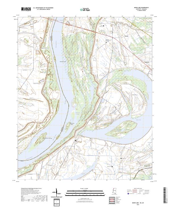
2024 Map of Moon Lake
USGS Topo · Published 2024About this map
Mississippi River dynamics dominate this landscape along the border of Arkansas and Mississippi, where the river's shifting path is recorded in features like Montezuma Bend, Montezuma Cut-Off, and Montezuma Towhead. The map reveals a floodplain terrain defined by expansive oxbows and secondary waterways, including the large Moon Lake and the marshy Willow Swamp. Settlement is concentrated along the levees and higher ground, with the small communities of Powell and Danforth serving as local anchors.
Find a feature on this map
59 named features on this map. Tap any name to fly to it.
Don’t see what you’re looking for? This feature index may not catch every label — zoom into the map to look around manually.
Map Details
Editions of this 2024 Moon Lake Map
This is the sole edition of this map. No revisions or reprints were ever made.
Other maps of this area

1908 · Lula
USGS Topo · 1:24,000

1908 · Dundee
USGS Topo · 1:24,000

1908 · Coahoma
USGS Topo · 1:24,000

1908 · Moon Lake
USGS Topo · 1:24,000

1908 · Jonestown
USGS Topo · 1:24,000

1910 · Dundee
USGS Topo · 1:31,680

1910 · Coahoma
USGS Topo · 1:31,680

1910 · Jonestown
USGS Topo · 1:31,680

1912 · Moon Lake
USGS Topo · 1:31,680

1912 · Lula
USGS Topo · 1:31,680