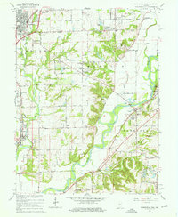
1965 Map of Mooresville East
USGS Topo · Published 1966About this map
The White River carves a winding path through this mid-1960s landscape, flanked by the dramatic topography of The Bluffs and Waverly Woods. To the north, the town of Mooresville serves as a hub, marked by the Pennsylvania RR and local industry like the Sewage Disposal plant. This era shows a community in transition, with established centers like Brooklyn and Waverly punctuated by newer developments such as Crestview Heights and Brookmoor.
Find a feature on this map
62 named features on this map. Tap any name to fly to it.
Don’t see what you’re looking for? This feature index may not catch every label — zoom into the map to look around manually.
Map Details
Editions of this 1965 Mooresville East Map
3 editions found
Other maps of this area

1942 · Franklin
USGS Topo · 1:125,000

1947 · Franklin
USGS Topo · 1:62,500

1948 · Maywood
USGS Topo · 1:24,000

1948 · Trafalgar
USGS Topo · 1:24,000

1950 · Franklin
USGS Topo · 1:62,500

1952 · Bargersville
USGS Topo · 1:24,000

1953 · Bridgeport
USGS Topo · 1:24,000

1953 · Plainfield
USGS Topo · 1:24,000

1953 · Indianapolis
USGS Topo · 1:250,000

1955 · Cope
USGS Topo · 1:24,000