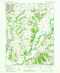
1965 Map of Mooresville East
USGS Topo · Published 1976About this map
The White River and its floodplain dominate the eastern edge of this landscape, while White Lick Creek carves a path through the west, passing the growing communities of Mooresville and Brooklyn. This 1965 revision shows a transition in land use, where traditional agricultural fields meet new residential developments like Brookmoor and Crestview Heights. The infrastructure of the era is evident in the Pennsylvania RR corridor and the industrial Gravel Pit operations near Waverly.
Find a feature on this map
55 named features on this map. Tap any name to fly to it.
Don’t see what you’re looking for? This feature index may not catch every label — zoom into the map to look around manually.
Map Details
Editions of this 1965 Mooresville East Map
3 editions found
Other maps of this area

1942 · Franklin
USGS Topo · 1:125,000

1947 · Franklin
USGS Topo · 1:62,500

1948 · Maywood
USGS Topo · 1:24,000

1948 · Trafalgar
USGS Topo · 1:24,000

1950 · Franklin
USGS Topo · 1:62,500

1952 · Bargersville
USGS Topo · 1:24,000

1953 · Bridgeport
USGS Topo · 1:24,000

1953 · Plainfield
USGS Topo · 1:24,000

1953 · Indianapolis
USGS Topo · 1:250,000

1955 · Cope
USGS Topo · 1:24,000