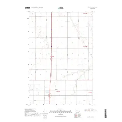
2017 Map of Mooreton East
USGS Topo · Published 2017About this map
Mooreton and the surrounding agricultural plains of Richland County are defined by a strict section-line grid of rural roads and the winding course of Antelope Creek. This landscape of the Red River Valley shows a highly organized township system, including portions of t132n r49w and t134n r48w. The map documents small nodes of activity like Fairview Junction and Farmington, which serve as markers for the region's transportation history and rural settlement patterns. While much of the terrain is dedicated to large-scale farming, the riparian corridor of Antelope Cr provides the primary natural deviation from the rectilinear survey lines. These waterways and road crossings, such as those along Co Rd 10 and Co Rd 12, highlight the essential infrastructure that supports the local economy and small-town North Dakota life.
Find a feature on this map
29 named features on this map. Tap any name to fly to it.
Don’t see what you’re looking for? This feature index may not catch every label — zoom into the map to look around manually.
Map Details
Editions of this 2017 Mooreton East Map
This is the sole edition of this map. No revisions or reprints were ever made.
Other maps of this area

1904 · Wahpeton
USGS Topo · 1:125,000

1953 · Fargo
USGS Topo · 1:250,000

1956 · Fargo
USGS Topo · 1:250,000

1959 · Mooreton NW
USGS Topo · 1:24,000

1960 · Galchutt
USGS Topo · 1:24,000

1960 · Mooreton West
USGS Topo · 1:24,000

1960 · Mooreton East
USGS Topo · 1:24,000

1964 · Fairmount NW
USGS Topo · 1:24,000

1964 · Mantador
USGS Topo · 1:24,000

1964 · Great Bend
USGS Topo · 1:24,000