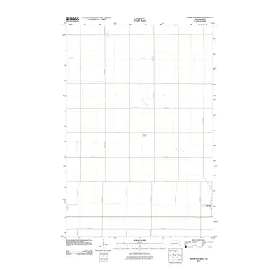
2011 Map of Mooreton West
USGS Topo · Published 2011About this map
The prairie landscape of Richland County is defined by the wandering path of Antelope Creek, which meanders across the rural terrain west of the settlement of Mooreton. This 2011 survey illustrates the precise section-line road grid that governs the region, with north-south corridors like 168th Ave SE and 164th Ave SE crossing east-west routes such as 72nd St SE and 80th St SE.
Find a feature on this map
21 named features on this map. Tap any name to fly to it.
Don’t see what you’re looking for? This feature index may not catch every label — zoom into the map to look around manually.
Map Details
Editions of this 2011 Mooreton West Map
This is the sole edition of this map. No revisions or reprints were ever made.
Other maps of this area

1904 · Wahpeton
USGS Topo · 1:125,000

1907 · Wyndmere
USGS Topo · 1:125,000

1953 · Fargo
USGS Topo · 1:250,000

1956 · Fargo
USGS Topo · 1:250,000

1959 · Wyndmere NE
USGS Topo · 1:24,000

1959 · Mooreton NW
USGS Topo · 1:24,000

1960 · Galchutt
USGS Topo · 1:24,000

1960 · Mooreton West
USGS Topo · 1:24,000

1960 · Wyndmere SE
USGS Topo · 1:24,000

1960 · Mooreton East
USGS Topo · 1:24,000