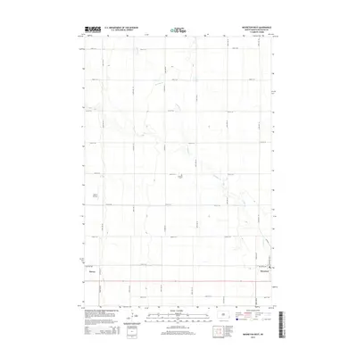
2014 Map of Mooreton West
USGS Topo · Published 2014About this map
Antelope Cr meanders across this Richland County landscape, defining the local drainage and agricultural patterns of the early 21st century. The map centers on a classic North Dakota section-line grid, where roads like Co Road 25 and 167th Ave SE facilitate the movement of goods between the prairie's small rail-aligned hubs. For those tracing local heritage, the Antelope Cem serves as a critical landmark in the rural interior, while the Moffet Airstrip indicates the importance of private aviation to the regional economy. The eastern edge captures the interface between the open fields and the outskirts of Mooreton, where Industrial Dr and Mooreton Ave N mark the transition from farmland to town life. To the west, the settlement of Barney sits at the crossing of 163rd Ave SE, anchoring the western reach of this survey.
Find a feature on this map
26 named features on this map. Tap any name to fly to it.
Don’t see what you’re looking for? This feature index may not catch every label — zoom into the map to look around manually.
Map Details
Editions of this 2014 Mooreton West Map
This is the sole edition of this map. No revisions or reprints were ever made.
Other maps of this area

1904 · Wahpeton
USGS Topo · 1:125,000

1907 · Wyndmere
USGS Topo · 1:125,000

1953 · Fargo
USGS Topo · 1:250,000

1956 · Fargo
USGS Topo · 1:250,000

1959 · Wyndmere NE
USGS Topo · 1:24,000

1959 · Mooreton NW
USGS Topo · 1:24,000

1960 · Galchutt
USGS Topo · 1:24,000

1960 · Mooreton West
USGS Topo · 1:24,000

1960 · Wyndmere SE
USGS Topo · 1:24,000

1960 · Mooreton East
USGS Topo · 1:24,000