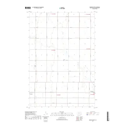
2018 Map of Mooreton West
USGS Topo · Published 2018About this map
Antelope Cr meanders through this portion of Richland County, defining the drainage patterns of a landscape meticulously organized by the Public Land Survey System. The eastern edge of the map features the village of Mooreton, where Industrial Dr hints at the local economy, while the settlement of Barney sits in the southwest corner along Red River Ave. These small agricultural hubs are connected by a rigid grid of section roads, including Co Rd 10 and Co Rd 3. Local landmarks such as the Antelope Cem and the Moffet Airstrip provide specific points of interest for genealogists and local historians tracing family land tracts or small-scale aviation history in the Red River Valley region.
Find a feature on this map
26 named features on this map. Tap any name to fly to it.
Don’t see what you’re looking for? This feature index may not catch every label — zoom into the map to look around manually.
Map Details
Editions of this 2018 Mooreton West Map
This is the sole edition of this map. No revisions or reprints were ever made.
Other maps of this area

1904 · Wahpeton
USGS Topo · 1:125,000

1907 · Wyndmere
USGS Topo · 1:125,000

1953 · Fargo
USGS Topo · 1:250,000

1956 · Fargo
USGS Topo · 1:250,000

1959 · Wyndmere NE
USGS Topo · 1:24,000

1959 · Mooreton NW
USGS Topo · 1:24,000

1960 · Galchutt
USGS Topo · 1:24,000

1960 · Mooreton West
USGS Topo · 1:24,000

1960 · Wyndmere SE
USGS Topo · 1:24,000

1960 · Mooreton East
USGS Topo · 1:24,000