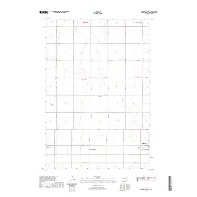
2020 Map of Mooreton West
USGS Topo · Published 2020About this map
Antelope Creek meanders across this southeastern North Dakota landscape, defining the local drainage patterns for the small agricultural communities of Barney and Mooreton. The map documents a classic Midwestern township and range grid, where section lines are traced by local thoroughfares such as County Road 10 and 76th Street SE. This rural landscape is punctuated by two notable burial grounds, Antelope Cemetery and Saint Anthony's Cemetery, which serve as vital landmarks for local family history and genealogical research. The presence of the Moffet Airstrip west of the creek suggests the continued importance of general aviation in supporting the region's expansive farming operations. Settlement is concentrated along the eastern and western margins, with the residential clusters of Mooreton and Barney providing the primary points of local commerce and community life.
Find a feature on this map
28 named features on this map. Tap any name to fly to it.
Don’t see what you’re looking for? This feature index may not catch every label — zoom into the map to look around manually.
Map Details
Editions of this 2020 Mooreton West Map
This is the sole edition of this map. No revisions or reprints were ever made.
Other maps of this area

1904 · Wahpeton
USGS Topo · 1:125,000

1907 · Wyndmere
USGS Topo · 1:125,000

1953 · Fargo
USGS Topo · 1:250,000

1956 · Fargo
USGS Topo · 1:250,000

1959 · Wyndmere NE
USGS Topo · 1:24,000

1959 · Mooreton NW
USGS Topo · 1:24,000

1960 · Galchutt
USGS Topo · 1:24,000

1960 · Mooreton West
USGS Topo · 1:24,000

1960 · Wyndmere SE
USGS Topo · 1:24,000

1960 · Mooreton East
USGS Topo · 1:24,000