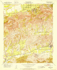
1951 Map of Moorpark
USGS Topo · Published 1952About this map
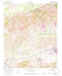
Moorpark is centered in this early 1950s study of Ventura County, where the agricultural flats of Simi Valley and the Las Posas Hills meet. The area is dominated by an extensive network of orchards and oil wells, particularly concentrated around Oak Ridge and the Santa Clara River. In the northern section, the community of Bardsdale sits along South Mountain Road, anchored by the Bardsdale Cem and the irrigation infrastructure essential to the valley's citrus and nut groves.
Find a feature on this map
36 named features on this map. Tap any name to fly to it.
Don’t see what you’re looking for? This feature index may not catch every label — zoom into the map to look around manually.
Map Details
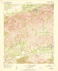
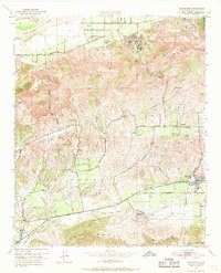
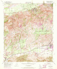
Editions of this 1951 Moorpark Map
5 editions found
Other maps of this area

1900 · Triunfo Pass
USGS Topo · 1:62,500

1900 · Piru
USGS Topo · 1:62,500

1903 · Santa Paula
USGS Topo · 1:62,500

1903 · Camulos
USGS Topo · 1:125,000

1904 · Hueneme
USGS Topo · 1:62,500

1921 · Piru
USGS Topo · 1:62,500

1921 · Triunfo Pass
USGS Topo · 1:62,500

1941 · Piru
USGS Topo · 1:62,500

1942 · Santa Paula
USGS Topo · 1:62,500

1942 · Hueneme
USGS Topo · 1:62,500