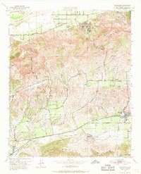
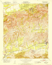
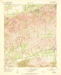
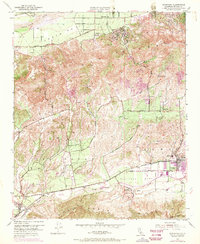
1951 Map of Moorpark
USGS Topo · Published 1968About this map
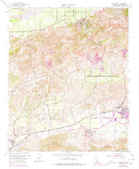
Moorpark and the surrounding citrus groves of the Little Simi Valley define this mid-century landscape in Ventura County. The settlement patterns reflect an agricultural economy reliant on the Southern Pacific railroad, which runs parallel to Los Angeles Ave. In the north, the Santa Clara River flows past the established community of Bardsdale, where the Bardsdale Cem and local school signify a stable rural population.
Find a feature on this map
39 named features on this map. Tap any name to fly to it.
Don’t see what you’re looking for? This feature index may not catch every label — zoom into the map to look around manually.
Map Details
Editions of this 1951 Moorpark Map
5 editions found
Other maps of this area

1900 · Triunfo Pass
USGS Topo · 1:62,500

1900 · Piru
USGS Topo · 1:62,500

1903 · Santa Paula
USGS Topo · 1:62,500

1903 · Camulos
USGS Topo · 1:125,000

1904 · Hueneme
USGS Topo · 1:62,500

1921 · Piru
USGS Topo · 1:62,500

1921 · Triunfo Pass
USGS Topo · 1:62,500

1941 · Piru
USGS Topo · 1:62,500

1942 · Santa Paula
USGS Topo · 1:62,500

1942 · Hueneme
USGS Topo · 1:62,500