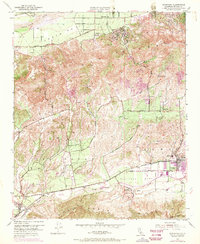
1951 Map of Moorpark
USGS Topo · Published 1970About this map
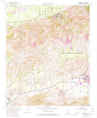
Santa Clara River bottomlands and the rugged terrain of South Mountain define this mid-century view of Ventura County. The landscape is characterized by deep drainage systems like Grimes Canyon and Balcom Canyon that cut through Oak Ridge, separating the northern citrus groves of Bardsdale from the emerging ranch and residential developments to the south. Purple revisions added in 1969 show the growth of Moorpark near the Southern Pacific tracks, including new streets and the expansion of Moorpark Home Acres. Local infrastructure is well-documented, from the Bardsdale Cem and Union High Sch to the winding course of Arroyo Las Posas. The transition from rural foothills to the structured grid of Simi Valley is evident, particularly around the settlements of Epworth and Fairview.
Find a feature on this map
32 named features on this map. Tap any name to fly to it.
Don’t see what you’re looking for? This feature index may not catch every label — zoom into the map to look around manually.
Map Details
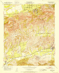
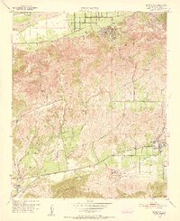
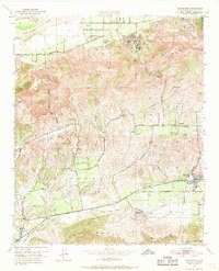
Editions of this 1951 Moorpark Map
5 editions found
Other maps of this area

1900 · Triunfo Pass
USGS Topo · 1:62,500

1900 · Piru
USGS Topo · 1:62,500

1903 · Santa Paula
USGS Topo · 1:62,500

1903 · Camulos
USGS Topo · 1:125,000

1904 · Hueneme
USGS Topo · 1:62,500

1921 · Piru
USGS Topo · 1:62,500

1921 · Triunfo Pass
USGS Topo · 1:62,500

1941 · Piru
USGS Topo · 1:62,500

1942 · Santa Paula
USGS Topo · 1:62,500

1942 · Hueneme
USGS Topo · 1:62,500