
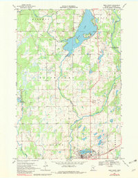
1968 Map of Mora North
USGS Topo · Published 1970About this map
Knife Lake dominates the upper half of this Kanabec County landscape, its irregular shoreline punctuated by Indian Mounds Park and a prominent spillway. The map records a rural Minnesota transition during the late 1960s, where the city of Mora sits at the southern edge, supported by the Mora Municipal Airport and the Northern railroad line. The surrounding countryside is defined by the winding paths of the Snake River and Ann River, alongside large conservation tracts like the Whited State Wildlife Management Area. Genealogists and local historians can pinpoint long-standing community landmarks such as Hillman Ch and the Knife Lake Cem, while an Old Railroad Grade running through the township of Hillman reveals the path of former transit corridors that once connected these timber and farming communities.
Find a feature on this map
28 named features on this map. Tap any name to fly to it.
Don’t see what you’re looking for? This feature index may not catch every label — zoom into the map to look around manually.
Map Details
Editions of this 1968 Mora North Map
2 editions found
Other maps of this area

1953 · Duluth
USGS Topo · 1:250,000

1953 · Stillwater
USGS Topo · 1:250,000

1955 · Stillwater
USGS Topo · 1:250,000

1958 · Stillwater
USGS Topo · 1:250,000

1958 · Duluth
USGS Topo · 1:250,000

1961 · Brook Park
USGS Topo · 1:62,500

1965 · Stillwater
USGS Topo · 1:250,000

1968 · Ann Lake
USGS Topo · 1:24,000

1968 · Isle SW
USGS Topo · 1:24,000

1968 · Pomroy Lake
USGS Topo · 1:24,000