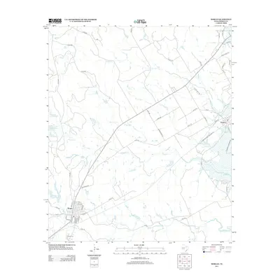
2012 Map of Morgan
USGS Topo · Published 2012About this map
Morgan stands at the intersection of local history and the modern rural landscape, its grid defined by streets like Bertha and Louise while the Morgan Cem lies just to the south. The landscape is characterized by a network of seasonal watercourses including Steele Cr and Mesquite Cr, which flow toward the eastern reach of Lake Whitney. Near the northeastern corner, the settlement of Kopperl provides access to the shoreline via Plowman Creek Park Rd. This area reflects the transition from traditional ranching and farming lands to the recreational influence of the reservoir, as seen in the cluster of private water bodies such as El Colina Lake Number 5. The intricate network of county roads and farm-to-market routes like FM-56 connects these small Bosque County communities through a terrain carved by Raymond Cr and Plowman Cr.
Find a feature on this map
54 named features on this map. Tap any name to fly to it.
Don’t see what you’re looking for? This feature index may not catch every label — zoom into the map to look around manually.
Map Details
Editions of this 2012 Morgan Map
This is the sole edition of this map. No revisions or reprints were ever made.
Other maps of this area

1888 · Meridian
USGS Topo · 1:125,000

1889 · Granbury
USGS Topo · 1:125,000

1891 · Cleburne
USGS Topo · 1:125,000

1892 · Waco
USGS Topo · 1:125,000

1894 · Meridian
USGS Topo · 1:125,000

1894 · Cleburne
USGS Topo · 1:125,000

1920 · Waco
USGS Topo · 1:125,000

1924 · Cleburne 3-B
USGS Topo · 1:48,000

1924 · Waco 2-b
USGS Topo · 1:48,000

1924 · Cleburne 3-C
USGS Topo · 1:48,000