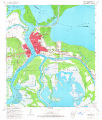
1966 Map of Morgan City
USGS Topo · Published 1967About this map
The deep-water geography of the Atchafalaya basin dominates this mid-1960s study of Morgan City and its surroundings. Positioned at the critical junction of the Lower Atchafalaya River and the Intracoastal Waterway, the map illustrates a landscape defined by industry and navigation. Significant infrastructure supporting the region's energy economy is evident at the Lake Palourde Gas Field and the Gas And Oil Field located in the wetlands near Bateman Lake. The density of the town centers shows a mature urban environment, featuring numerous educational institutions such as Berwick High Sch, Central High Sch, and Sacred Heart Sch.
Find a feature on this map
68 named features on this map. Tap any name to fly to it.
Don’t see what you’re looking for? This feature index may not catch every label — zoom into the map to look around manually.
Map Details
Editions of this 1966 Morgan City Map
2 editions found
Other maps of this area

1935 · Morgan City
USGS Topo · 1:62,500

1941 · Belle Isle
USGS Topo · 1:62,500

1945 · New Orleans
USGS Topo · 1:250,000

1948 · Foster
USGS Topo · 1:62,500

1953 · Napoleonville
USGS Topo · 1:62,500

1954 · Morgan City
USGS Topo · 1:62,500

1954 · Belle Isle
USGS Topo · 1:62,500

1959 · Foster
USGS Topo · 1:62,500

1963 · New Orleans
USGS Topo · 1:250,000
1965 · Grassy Lake
USGS Topo · 1:24,000