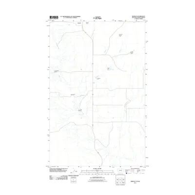
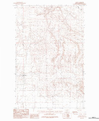
2011 Map of Morgan
USGS Topo · Published 2011About this map
Morgan sits at the northern edge of Phillips County, just south of the international border with Saskatchewan. This high plains landscape is defined by the drainage patterns of Whitewater Creek, which winds through the western half of the map. Several distinctive geographic depressions, or coulees, carve through the prairie, including Cottonwood Coulee, Big Coulee, and Lone Tree Coulee. These features indicate the subtle but critical relief of the drainage basin in an otherwise flat expanse. The map highlights the localized water management necessary for this arid environment, evidenced by named reservoirs and irrigation points like French Fry Number 1 Dam, Jumbo Number 1 Dam, PR-54 Dam, and Compton Dam. Transportation in this northern Montana outpost is anchored by the Morgan Airport, serving as a vital link for this sparsely populated border region.
Find a feature on this map
10 named features on this map. Tap any name to fly to it.
Don’t see what you’re looking for? This feature index may not catch every label — zoom into the map to look around manually.
Map Details
Editions of this 2011 Morgan Map
This is the sole edition of this map. No revisions or reprints were ever made.
Other maps of this area

1920 · Cowan
USGS Topo · 1:125,000

1954 · Glasgow
USGS Topo · 1:250,000

1957 · Glasgow
USGS Topo · 1:250,000

1958 · Glasgow
USGS Topo · 1:250,000

1984 · Whitewater West
USGS Topo · 1:24,000

1984 · Morgan
USGS Topo · 1:24,000
1984 · Loring NW
USGS Topo · 1:24,000
1984 · Martin Lake
USGS Topo · 1:24,000
1984 · Gustin Coulee
USGS Topo · 1:24,000
1984 · Loring
USGS Topo · 1:24,000