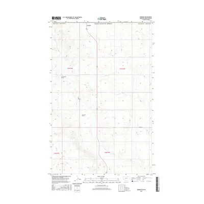
2017 Map of Morgan
USGS Topo · Published 2017About this map
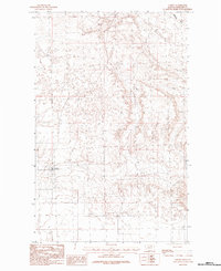
The small settlement of Morgan sits at the northern edge of this 2017 study, where the highway crosses the international boundary between the United States of America and Canada. This high-plains landscape in Phillips County is defined by an intricate network of drainage features, notably Cottonwood Coulee, Big Coulee, and Lone Tree Coulee, which carve through the prairie. The grid-like organization of the Public Land Survey System is clearly visible, with section lines and local thoroughfares like Border Rd providing the primary structure for the remote ranching and agricultural territory. The map illustrates the sparsely populated nature of the Big Sky Country, showing how modern infrastructure follows the traditional pathways of early twentieth-century land claims and the topography of the Montana-Saskatchewan borderlands.
Find a feature on this map
12 named features on this map. Tap any name to fly to it.
Don’t see what you’re looking for? This feature index may not catch every label — zoom into the map to look around manually.
Map Details
Editions of this 2017 Morgan Map
This is the sole edition of this map. No revisions or reprints were ever made.
Other maps of this area

1920 · Cowan
USGS Topo · 1:125,000

1954 · Glasgow
USGS Topo · 1:250,000

1957 · Glasgow
USGS Topo · 1:250,000

1958 · Glasgow
USGS Topo · 1:250,000

1984 · Whitewater West
USGS Topo · 1:24,000

1984 · Morgan
USGS Topo · 1:24,000
1984 · Loring NW
USGS Topo · 1:24,000
1984 · Martin Lake
USGS Topo · 1:24,000
1984 · Gustin Coulee
USGS Topo · 1:24,000
1984 · Loring
USGS Topo · 1:24,000