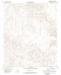
1955 Map of Morgans Well
USGS Topo · Published 1986About this map
The Bullion Mountains dominate this high-desert landscape in the mid-1950s, a period when this San Bernardino County terrain was being integrated into the Marine Corps Training Center. The map reveals a transition from traditional desert extraction to military reservation, with the Reservation Boundary bisecting the northern portion of the quadrangle. Early mining activity is evidenced by several Mine Tunnels and Mine Shafts located near the northern edge of the survey.
Find a feature on this map
11 named features on this map. Tap any name to fly to it.
Don’t see what you’re looking for? This feature index may not catch every label — zoom into the map to look around manually.
Map Details
Editions of this 1955 Morgans Well Map
4 editions found
Other maps of this area

1953 · San Bernardino
USGS Topo · 1:250,000

1954 · Hidalgo Mtn
USGS Topo · 1:24,000

1954 · Ludlow SE
USGS Topo · 1:24,000

1955 · Deadman Lake NW
USGS Topo · 1:24,000

1955 · Ludlow
USGS Topo · 1:24,000

1955 · Lavic SE
USGS Topo · 1:24,000

1955 · Morgans Well
USGS Topo · 1:24,000

1955 · Deadman Lake NE
USGS Topo · 1:24,000

1955 · Ash Hill
USGS Topo · 1:24,000

1955 · Lavic Lake
USGS Topo · 1:24,000