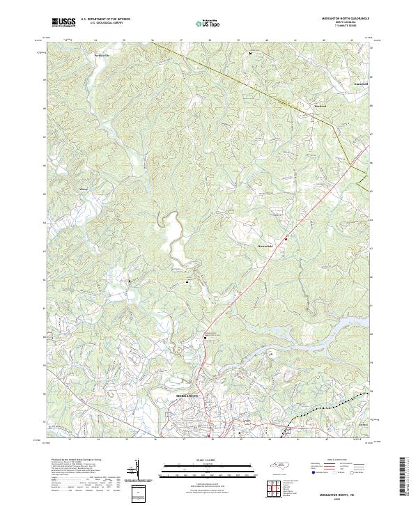
2022 Map of Morganton North
USGS Topo · Published 2022About this map
The Catawba River and the meandering Johns River converge near Morganton, forming a complex drainage network that has long defined the topography of this portion of Burke and Caldwell counties. This modern survey illustrates the persistent rural character of settlements like Worry, Chesterfield, and Perkinsville, where family-named landmarks such as Houck Cem and Bost Cem offer essential anchor points for genealogists. The map details a landscape where traditional creek names like Warrior Fork and White Mill Cr meet contemporary residential expansion. Local history is deeply embedded in the layout of the land, from the clustered church grounds at Catawba Valley Baptist Church Cem to the industrial and suburban edges of Drexel and Gamewell. The transition from the river bottoms to the rising elevations of the foothills is traced through a dense network of secondary roads, including Old Johns River Rd and Piedmont Rd.
Find a feature on this map
134 named features on this map. Tap any name to fly to it.
Don’t see what you’re looking for? This feature index may not catch every label — zoom into the map to look around manually.
Map Details
Editions of this 2022 Morganton North Map
This is the sole edition of this map. No revisions or reprints were ever made.
Other maps of this area

1905 · Morganton
USGS Topo · 1:125,000

1953 · Charlotte
USGS Topo · 1:250,000

1954 · Charlotte
USGS Topo · 1:250,000

1956 · Valdese
USGS Topo · 1:24,000

1956 · Oak Hill
USGS Topo · 1:24,000

1956 · Collettsville
USGS Topo · 1:24,000

1956 · Morganton North
USGS Topo · 1:24,000

1956 · Morganton South
USGS Topo · 1:24,000

1956 · Lenoir
USGS Topo · 1:24,000
1956 · Chestnut Mtn.
USGS Topo · 1:24,000