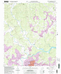
2002 Map of Morganton North
USGS Topo · Published 2003About this map
The Johns River snakes through the center of this terrain, meeting the Catawba River just north of Morganton. This landscape is defined by its numerous small-scale communities and religious foundations, including the Missionary Ch and Mission Ch located along the river's winding course. The map details the transition from rural crossroads like Arneys Store to the growing corporate limits of the county seat.
Find a feature on this map
53 named features on this map. Tap any name to fly to it.
Don’t see what you’re looking for? This feature index may not catch every label — zoom into the map to look around manually.
Map Details
Editions of this 2002 Morganton North Map
This is the sole edition of this map. No revisions or reprints were ever made.
Other maps of this area

1905 · Morganton
USGS Topo · 1:125,000

1953 · Charlotte
USGS Topo · 1:250,000

1954 · Charlotte
USGS Topo · 1:250,000

1956 · Valdese
USGS Topo · 1:24,000

1956 · Oak Hill
USGS Topo · 1:24,000

1956 · Collettsville
USGS Topo · 1:24,000

1956 · Morganton North
USGS Topo · 1:24,000

1956 · Morganton South
USGS Topo · 1:24,000

1956 · Lenoir
USGS Topo · 1:24,000
1956 · Chestnut Mtn.
USGS Topo · 1:24,000