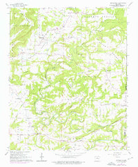
1961 Map of Morganton
USGS Topo · Published 1976About this map
Davis Valley and the winding North Fork Cadron Creek anchor this mid-century portrait of Van Buren and Cleburne counties. Small agricultural communities such as Morganton and Gravesville are documented alongside numerous country congregations, including Colony Ch, Sardis Ch, and Mount Zion Ch. A distinctive historical marker on this landscape is the Old Indian Treaty Boundary, which cuts across the terrain of Negro Hill and the surrounding woodlands. The map captures the area's rural character through its network of unnamed local roads and family-named landmarks like Odom Point and Rock House Hill. To the west, the landscape rises into Hunter Mountain and East Mountain, while the southern reaches follow the drainage of White Oak Creek and Addler Br.
Find a feature on this map
40 named features on this map. Tap any name to fly to it.
Don’t see what you’re looking for? This feature index may not catch every label — zoom into the map to look around manually.
Map Details
Editions of this 1961 Morganton Map
2 editions found
Other maps of this area

1892 · Mountain View
USGS Topo · 1:125,000

1894 · Mountain View
USGS Topo · 1:125,000

1956 · Russellville
USGS Topo · 1:250,000

1961 · Bee Branch
USGS Topo · 1:62,500

1961 · Bee Branch
USGS Topo · 1:24,000

1961 · Morganton
USGS Topo · 1:24,000

1961 · Damascus
USGS Topo · 1:24,000

1961 · Guy
USGS Topo · 1:24,000

1963 · Quitman
USGS Topo · 1:24,000
1963 · Barney
USGS Topo · 1:24,000