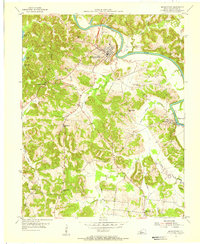
1954 Map of Morgantown
USGS Topo · Published 1956About this map
The Green River carves a deep, winding path through the heart of Butler County, anchoring the commercial life of Morgantown and the nearby village of Aberdeen. This mid-1950s landscape is defined by the sharp contrast between the active river corridor—marked by infrastructure like Lock No 4 and the U S Reservation at Woodbury—and the deeply dissected ridges to the west. Landmarks like Hagan Shanty Ridge and Deer Lick Hollow illustrate the difficult terrain that once isolated rural communities. Local life centers on small crossroads and institutions, including Carved Rock School and Pleasant Rock Church. The map also captures early industrial footprints with a Strip Mine located south of the main town, while the southern reaches near Leetown show a network of small family cemeteries and schools, such as Little Muddy School, that served the agricultural hinterland.
Find a feature on this map
39 named features on this map. Tap any name to fly to it.
Don’t see what you’re looking for? This feature index may not catch every label — zoom into the map to look around manually.
Map Details
Editions of this 1954 Morgantown Map
2 editions found
Other maps of this area

1909 · Hartford
USGS Topo · 1:62,500

1911 · Dunmor
USGS Topo · 1:48,000

1914 · Little Muddy
USGS Topo · 1:62,500

1914 · Dunmor
USGS Topo · 1:62,500

1925 · Spring Lick
USGS Topo · 1:62,500

1953 · South Hill
USGS Topo · 1:24,000

1953 · Quality
USGS Topo · 1:24,000

1954 · Evansville
USGS Topo · 1:250,000

1954 · Welchs Creek
USGS Topo · 1:24,000
1954 · Cromwell
USGS Topo · 1:24,000