
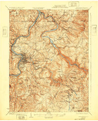
1925 Map of Morgantown
USGS Topo · Published 1925About this map
The Monongahela River and Cheat River converge in this 1925 survey, showing the expansion of Morgantown alongside its industrial and academic development. The map details the complex rail networks of the Baltimore and Ohio Railroad and the Morgantown and Kingwood Railroad, which follow the river valleys and the winding path of Deckers Creek. To the east, the steep rise of Chestnut Ridge dominates the landscape, providing a sharp contrast to the riverfront settlements.
Find a feature on this map
113 named features on this map. Tap any name to fly to it.
Don’t see what you’re looking for? This feature index may not catch every label — zoom into the map to look around manually.
Map Details
Editions of this 1925 Morgantown Map
2 editions found
Other maps of this area

1886 · St. George
USGS Topo · 1:125,000

1891 · St. George
USGS Topo · 1:125,000

1900 · Uniontown
USGS Topo · 1:62,500

1900 · Masontown
USGS Topo · 1:62,500

1901 · Waynesburg
USGS Topo · 1:62,500

1902 · Fairmont
USGS Topo · 1:62,500

1902 · Morgantown
USGS Topo · 1:62,500

1903 · Masontown
USGS Topo · 1:62,500

1904 · Bruceton
USGS Topo · 1:62,500

1904 · Blacksville
USGS Topo · 1:62,500