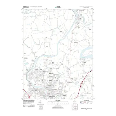
2011 Map of Morgantown North
USGS Topo · Published 2011About this map
The Monongahela River carves a deep valley through this northern West Virginia landscape, serving as a primary corridor for the Monongahela Railway and several industrial landings. The river also marks the approach to Morgantown, where the West Virginia University Main Campus and specialized facilities like the West Virginia University School of Dentistry anchor the southern portion of the sheet. To the north, the confluence of the Cheat River and the Monongahela near Point Marion highlights the area's historical reliance on water transport, a legacy further evidenced by Evans Ferry and Madisons Landing.
Find a feature on this map
144 named features on this map. Tap any name to fly to it.
Don’t see what you’re looking for? This feature index may not catch every label — zoom into the map to look around manually.
Map Details
Editions of this 2011 Morgantown North Map
This is the sole edition of this map. No revisions or reprints were ever made.
Other maps of this area

1900 · Masontown
USGS Topo · 1:62,500

1901 · Waynesburg
USGS Topo · 1:62,500

1902 · Morgantown
USGS Topo · 1:62,500

1903 · Masontown
USGS Topo · 1:62,500

1904 · Blacksville
USGS Topo · 1:62,500

1904 · Waynesburg
USGS Topo · 1:62,500

1923 · Blacksville
USGS Topo · 1:62,500

1925 · Blacksville
USGS Topo · 1:62,500

1925 · Morgantown
USGS Topo · 1:62,500

1931 · Masontown
USGS Topo · 1:62,500