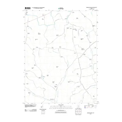
2010 Map of Morgantown
USGS Topo · Published 2010About this map
Seip Mound stands as a prominent landmark in the north near the winding course of Paint Creek. This landscape in Pike County is defined by a dense network of cemeteries and small rural settlements that speak to generations of local family history. From Morgantown in the south to Storms and Spargursville in the north, the map reveals a community organized around ridges and deep hollows. Recreational and spiritual life is anchored by Pike Lake and nearby Christian Union Church, while the numerous family and community burial grounds, such as Bond Chapel Cemetery and Mount Carmel Cemetery, provide a fine-grained resource for genealogical research. The topography is intricately labeled with local names like Tobacco Barn Hollow and Minnehan Bend, reflecting a deeply personal connection to the terrain.
Find a feature on this map
99 named features on this map. Tap any name to fly to it.
Don’t see what you’re looking for? This feature index may not catch every label — zoom into the map to look around manually.
Map Details
Editions of this 2010 Morgantown Map
This is the sole edition of this map. No revisions or reprints were ever made.
Other maps of this area

1912 · Roxabell
USGS Topo · 1:62,500

1914 · Roxabell
USGS Topo · 1:62,500

1915 · Bainbridge
USGS Topo · 1:48,000

1915 · Piketon
USGS Topo · 1:62,500

1917 · Bainbridge
USGS Topo · 1:62,500

1917 · Piketon
USGS Topo · 1:62,500

1917 · Greenfield
USGS Topo · 1:62,500

1944 · Piketon
USGS Topo · 1:62,500

1944 · Greenfield
USGS Topo · 1:62,500

1944 · Roxabell
USGS Topo · 1:62,500