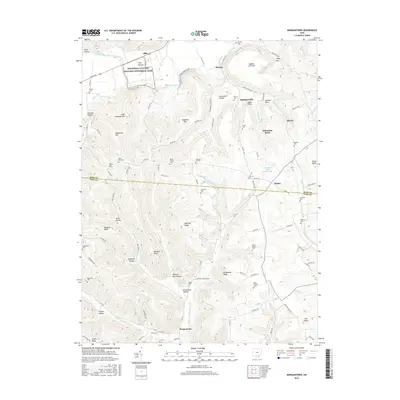
2016 Map of Morgantown
USGS Topo · Published 2016About this map
Seip Mound and the surrounding Hopewell Culture National Historical Park anchor the northern landscape of this region along Paint Creek. The terrain is defined by complex ridges and family-named hollows, including Robinett Ridge and Tobacco Barn Hollow, showing a persistent pattern of rural settlement. Small hamlets like Spargursville and Nipgen are connected by a network of township roads that navigate the local heights, such as Traub Knob and Potts Hill. Genealogists will find a high density of burial sites across the landscape, from the Mount Carmel Cem near McMechen Hill to the Bond Chapel Cem in the south. The southern portion of the map is dominated by the community of Morgantown and the winding course of the Right Fork Morgan Fork, illustrating the deep-rooted upland agricultural and social character of both Ross and Pike counties.
Find a feature on this map
110 named features on this map. Tap any name to fly to it.
Don’t see what you’re looking for? This feature index may not catch every label — zoom into the map to look around manually.
Map Details
Editions of this 2016 Morgantown Map
This is the sole edition of this map. No revisions or reprints were ever made.
Other maps of this area

1912 · Roxabell
USGS Topo · 1:62,500

1914 · Roxabell
USGS Topo · 1:62,500

1915 · Bainbridge
USGS Topo · 1:48,000

1915 · Piketon
USGS Topo · 1:62,500

1917 · Bainbridge
USGS Topo · 1:62,500

1917 · Piketon
USGS Topo · 1:62,500

1917 · Greenfield
USGS Topo · 1:62,500

1944 · Piketon
USGS Topo · 1:62,500

1944 · Greenfield
USGS Topo · 1:62,500

1944 · Roxabell
USGS Topo · 1:62,500