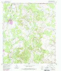
1967 Map of Mormon Mill
USGS Topo · Published 1987About this map
Mormon Mill (Historical Site) sits near the southern edge of this map, marking a focal point of early settlement and industry along Hamilton Creek. The site, accompanied by the Mill Pond and Mormon Mill Cem, serves as a anchor for local history near Burger Hollow. Northward, the landscape shifts toward the town of Burnet, where the Southern Pacific railroad and Burnet Municipal Airport reflect mid-century growth. The terrain is deeply carved by drainage systems including Hairston Creek and the South Fork San Gabriel River, with numerous gravel pits and quarries signaling a rural economy built on mineral extraction. Family heritage is preserved across the countryside in several small burial grounds such as Holland Cem and Norred Cem, while community life is represented by the Rodeo Ground and a Roadside Park along the highway corridor.
Find a feature on this map
29 named features on this map. Tap any name to fly to it.
Don’t see what you’re looking for? This feature index may not catch every label — zoom into the map to look around manually.
Map Details
Editions of this 1967 Mormon Mill Map
2 editions found
Other maps of this area

1887 · Burnet
USGS Topo · 1:125,000

1893 · Burnet
USGS Topo · 1:125,000

1903 · Burnet
USGS Topo · 1:125,000

1909 · Burnet
USGS Topo · 1:125,000

1925 · Burnet 3-d
USGS Topo · 1:48,000

1929 · Marble Falls
USGS Topo · 1:62,500

1932 · Tow
USGS Topo · 1:62,500

1932 · Marble Falls
USGS Topo · 1:62,500

1932 · Bertram
USGS Topo · 1:62,500

1954 · Llano
USGS Topo · 1:250,000