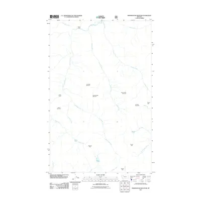
2011 Map of Morningstar Mountain
USGS Topo · Published 2011About this map
Morningstar Mountain and Spotted Eagle Mountain dominate this section of Flathead County, marking a landscape defined by sharp elevation changes and a dense network of high-altitude waterways. The drainage patterns here are complex, with South Badger Creek and its many tributaries, including Crucifixion Creek and Muskrat Creek, carving deep valleys between the peaks. The presence of several small alpine water bodies like Emerald Lake, Blue Lake, and Beaver Lake suggests a glaciated terrain where water is trapped in high basins.
Find a feature on this map
28 named features on this map. Tap any name to fly to it.
Don’t see what you’re looking for? This feature index may not catch every label — zoom into the map to look around manually.
Map Details
Editions of this 2011 Morningstar Mountain Map
This is the sole edition of this map. No revisions or reprints were ever made.
Other maps of this area

1913 · Marias Pass
USGS Topo · 1:125,000

1914 · Heart Butte
USGS Topo · 1:125,000

1918 · Heart Butte
USGS Topo · 1:125,000

1958 · Gable Peaks
USGS Topo · 1:24,000

1958 · Crescent Cliff
USGS Topo · 1:24,000

1960 · Cut Bank
USGS Topo · 1:250,000

1963 · Cut Bank
USGS Topo · 1:250,000

1964 · Cut Bank
USGS Topo · 1:250,000

1968 · Half Dome Crag
USGS Topo · 1:24,000

1968 · Swift Reservoir
USGS Topo · 1:24,000